

Tracking the Progress of Wildfires Using Satellite Multispectral Technologies in FusionMap
In recent years, the world has witnessed an alarming increase in the frequency and intensity of wildfires. These natural disasters pose a significant threat to ecosystems, human lives, and infrastructure. To effectively combat and manage wildfires, it is crucial to have accurate and timely information about their behavior and progression. In this regard, satellite multispectral technologies have emerged as invaluable tools in tracking the progress of wildfires. One such cutting-edge platform is FusionMap, which leverages multispectral data to provide real-time insights and aid in firefighting efforts. In this blog post, we will delve into the capabilities and benefits of using satellite multispectral technologies in FusionMap for monitoring and managing wildfires.
Understanding Multispectral Technologies
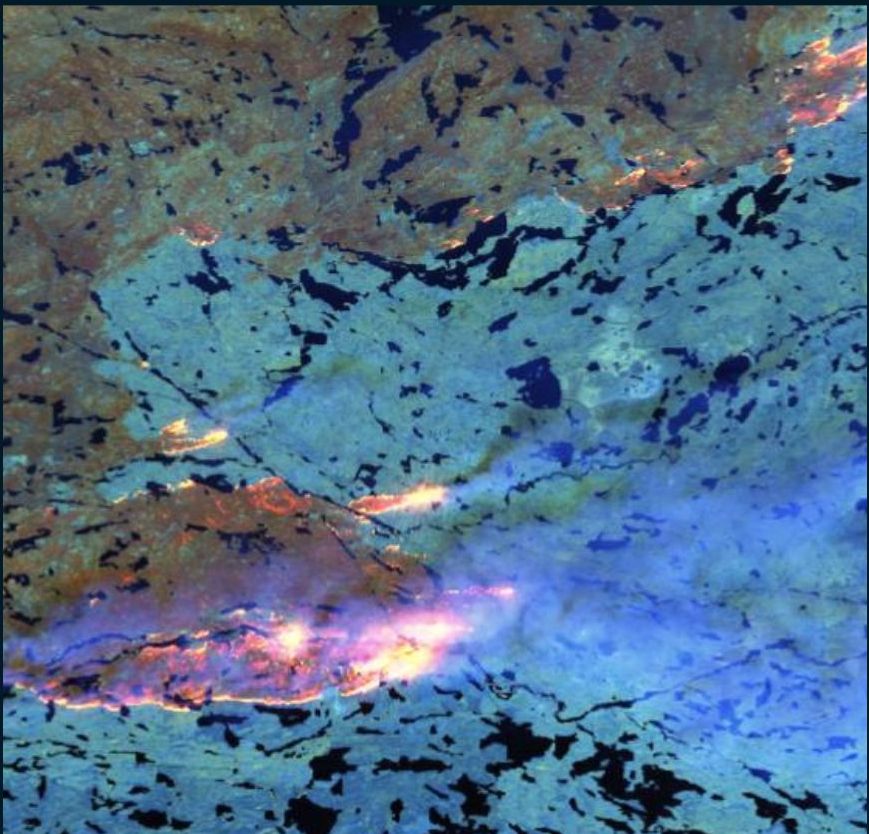
Multispectral technologies involve the use of satellite sensors that capture data across multiple bands of the electromagnetic spectrum. By analyzing these different wavelengths, scientists can gain valuable insights into various aspects of the Earth’s surface, including vegetation health, land use patterns, and environmental changes. In the context of wildfires, multispectral data can be utilized to track fire hotspots, monitor smoke plumes, assess burn severity, and detect early signs of flare-ups.
FusionMap: A Powerful Tool for Wildfire Monitoring
FusionMap is an advanced geospatial platform that integrates satellite imagery and other geospatial data to provide comprehensive and real-time information about wildfires. By combining multispectral data from different satellites, FusionMap offers a holistic view of the fire situation, enabling authorities and firefighting agencies to make informed decisions.
- Early Detection and Fire Hotspot Monitoring:
Satellite multispectral technologies in FusionMap play a vital role in early detection and monitoring of fire hotspots. By analyzing infrared and thermal bands, these technologies can identify areas with heightened temperature signatures, indicating potential wildfires. This early detection enables rapid response and swift deployment of firefighting resources to contain the flames before they escalate. - Smoke Plume Monitoring and Air Quality Assessment:
During wildfires, large volumes of smoke and pollutants are released into the atmosphere, posing health risks to nearby communities. FusionMap’s multispectral technologies help in tracking the movement and dispersion of smoke plumes. By analyzing the composition of the plumes, authorities can assess the potential impact on air quality and take necessary measures to protect public health. - Burn Severity Assessment and Ecosystem Recovery:
After a wildfire, assessing the burn severity and monitoring ecosystem recovery are crucial for understanding the long-term impacts and planning rehabilitation efforts. FusionMap’s multispectral capabilities enable detailed analysis of the affected areas. By comparing pre- and post-fire imagery, scientists can determine the severity of vegetation loss, identify areas prone to erosion, and monitor the regrowth of vegetation over time. This information aids in prioritizing recovery efforts and implementing effective land management strategies. - Real-time Decision Support for Firefighters:
FusionMap provides real-time data and decision support tools for firefighters on the ground. By integrating multispectral satellite imagery with other geospatial data, such as topography, weather conditions, and infrastructure maps, FusionMap enables firefighters to make informed decisions regarding fire containment, evacuation routes, and resource allocation. This enhances the overall effectiveness and safety of firefighting operations.
Satellite multispectral technologies in FusionMap have revolutionized the way wildfires are monitored and managed. By leveraging the power of multispectral data, FusionMap enables early detection, real-time monitoring, and informed decision-making during wildfire incidents. The ability to track fire hotspots, monitor smoke plumes, assess burn severity, and support firefighters on the ground makes FusionMap an invaluable tool in combating wildfires. As we continue to face the challenges posed by wildfires, the integration of advanced technologies like multispectral imaging in platforms such as FusionMap will undoubtedly play a vital role in mitigation of wildfires.